TGViewer
Geoalert Blog Geoalert Blog @geoalert · 413 subscribers
Post #859 204
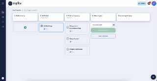
🛰️ My Imagery Search update in Mapflow

Have you ever struggled to find the right image among all the files you’ve uploaded?

A list of filenames is not always enough—especially when you need to check which images cover a specific project area without opening them one by one.

Now you can search across your own imagery and collections using the same tools available in Mapflow’s Imagery Search:

📍 Search for your data geographically or by intersection with your area of interest

👉 Additionally you can fill out the metadata profile for your image which enables more filters like Date, Clouds, Off-nadir, etc.

Your uploaded imagery is now easier to find, evaluate, and reuse across projects.
⚙️ Find suitable imagery and launch AI processing directly from the search results


Try it in Mapflow → https://app.mapflow.ai
  • 🔥 5
  • 👍 2
  • 🤩 1
More from @geoalert
  1. Oct 14, 2026From terrain to a radio plan, then kept current 1. Load the terrain Start from a terrain m…
  2. Oct 13, 2026🚗 Mapflow Roads Model — Update! We've released a significantly improved version of our Ro…
  3. Oct 9, 2026🚀 AOI list management further improvements While you're viewing the processing results ("…
  4. Oct 6, 2026🧑‍🤝‍🧑Team management, redesigned To tell the truth it didn't go well with the user's ad…
  5. Oct 2, 2026🌲 Forest and trees workflow was updated with two models, both benchmarked against thoroug…
  6. Oct 1, 2026📍AOI management update Have a long list of areas to map? You can process them one by one,…
Threads Profile ViewerView any public Threads profile without an account.Open ThreadLook →Writing with AI? Make it sound human.Metric37 rewrites AI drafts so they read naturally. Free AI detector, 1,500 words free.Try Metric37 →